Ultra Cuchilla Grande 2027
Distances
Four challenges in the Cuchilla Grande. Choose yours.
115K · The Horse
Expert level 👑 Queen Distance“With the strength of a horse, the journey becomes a feat.”
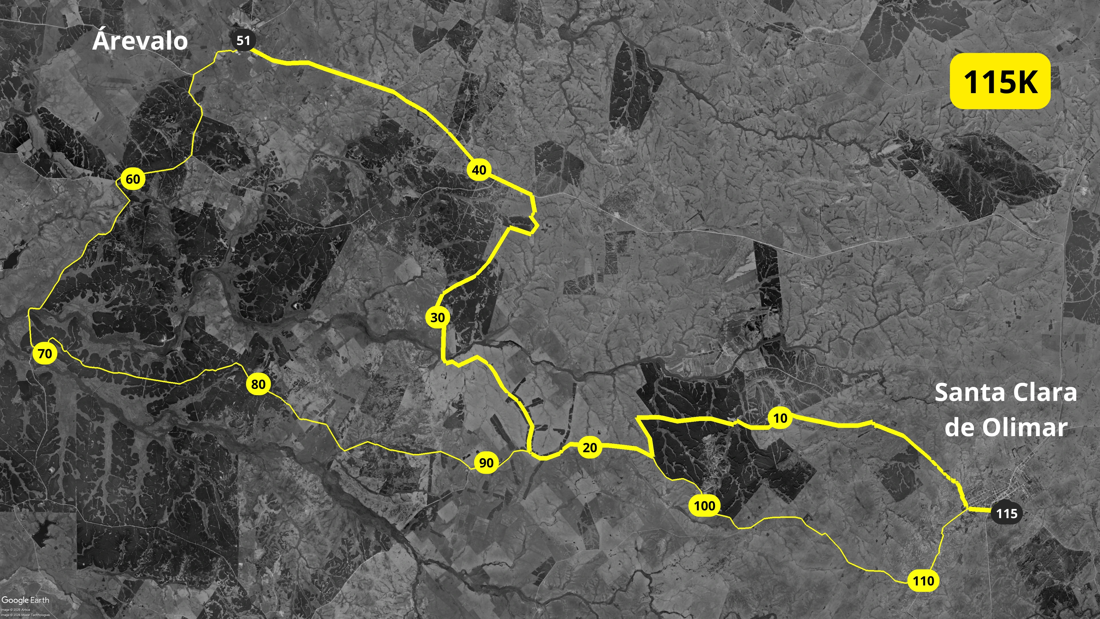
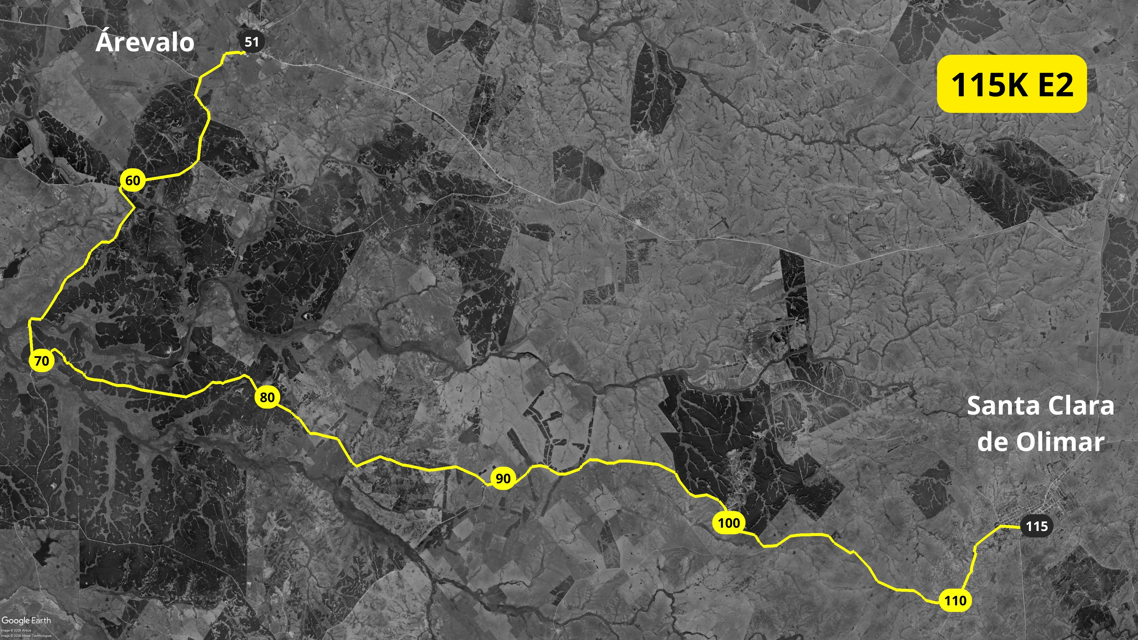
115 km over two days, with a night in Arévalo.
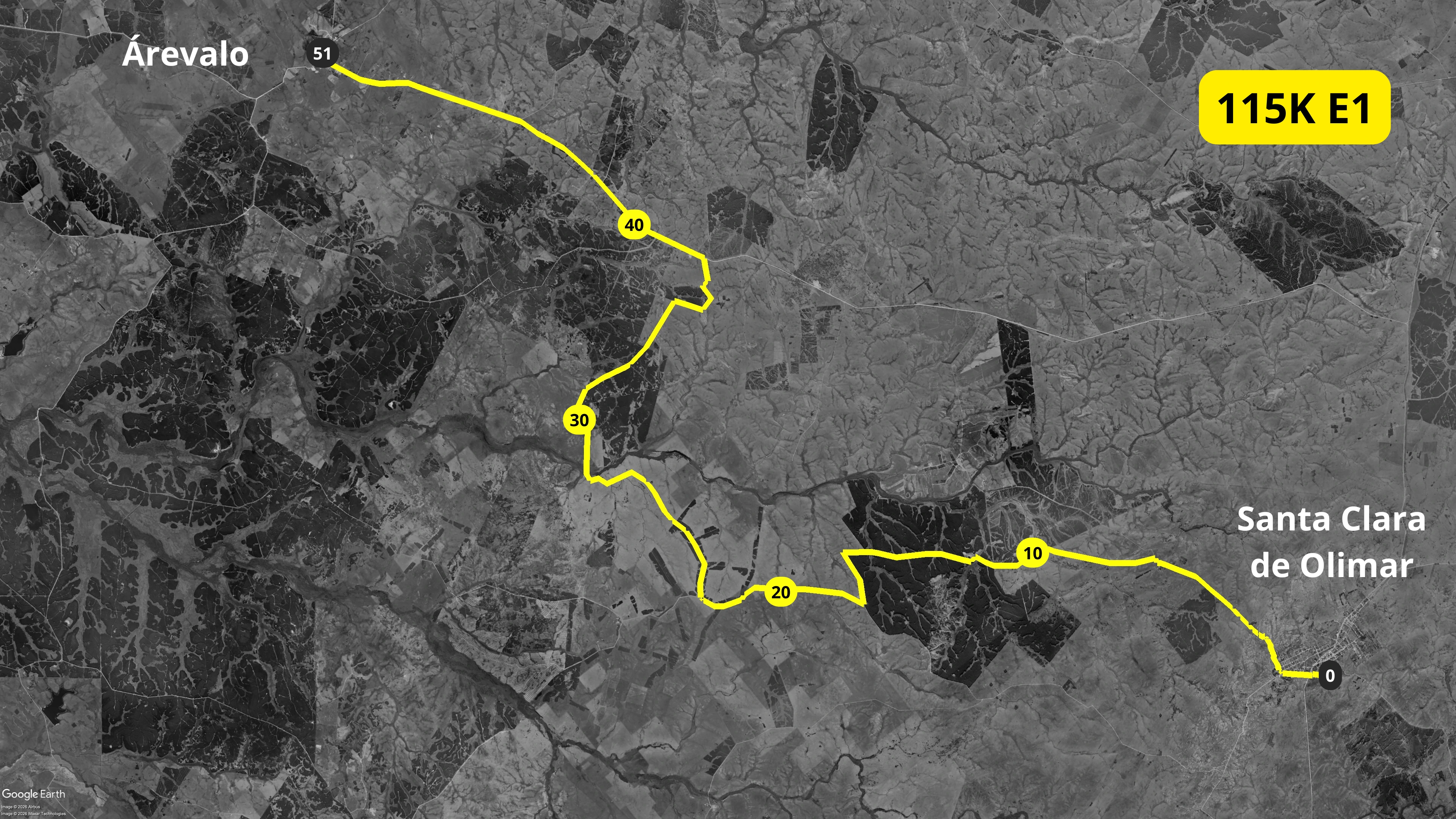
On Saturday you run from Santa Clara de Olimar to Arévalo (Cerro Largo), where the town welcomes you and you spend the night. On Sunday you head back to Santa Clara. Along the way: town streets, open countryside, streams, native woodland and forest plantations. It is the queen distance of the event and one of the toughest races in Uruguay.
- Sat 27 and Sun 28, 4:15 AMIn the dark with a headlamp; on Sunday, from Arévalo
- Night in ArévaloAccommodation included, at a local club
- +800 m elevation gainSpread over 114.56 km
- Semi-self-supportedYou carry your own water and food
It's for you if…
- You've already finished long-distance races and you're looking for the next step.
- You know how to manage your energy, hydration and food for many hours.
- You can handle running in heat, rain or mud: the race starts in any weather.
The two stages
Elevation + / −: total meters climbed and descended. The higher, the tougher.
| Section | Distance | D+Elevation gain | D−Elevation loss |
|---|---|---|---|
| Total | 114.56 km | +800 m | −807 m |
| Stage 1Santa Clara de Olimar → Arévalo | 50.97 km | +278 m | −387 m |
| Stage 2Arévalo → Santa Clara de Olimar | 63.59 km | +522 m | −420 m |
115K elevation profile
Altitude above sea level along the course: between 113 m and 333 m.
Official elevation profile, Stage 1 Official elevation profile, Stage 2
115K maps


54K · The Rhea
Advanced level“It knows no fences: it runs the whole countryside.”
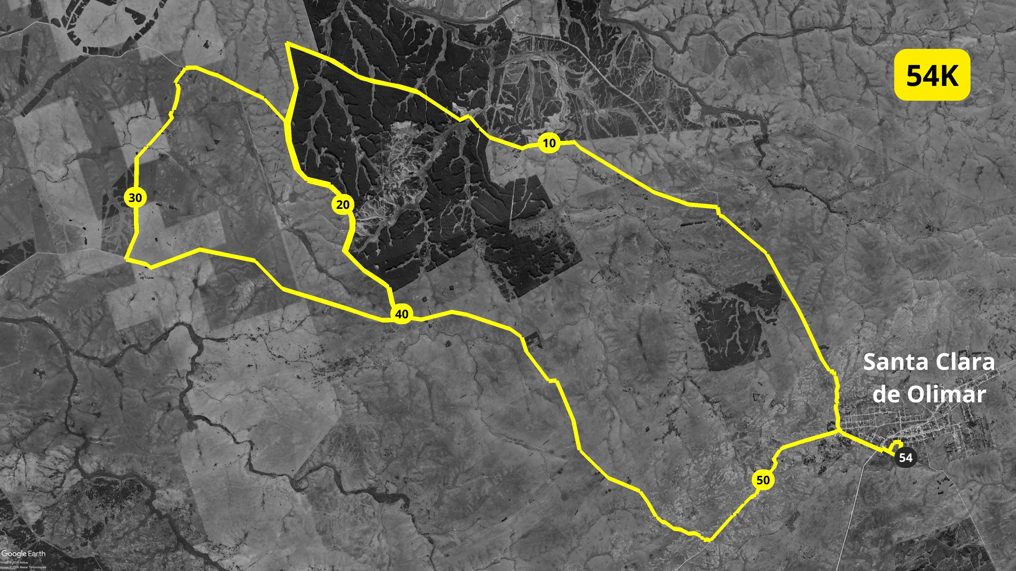
54 km in a single stage, starting in the dark.
You start at 4:00 AM from Santa Clara de Olimar, run the first hours with a headlamp and watch the sunrise mid-race. It is a demanding, technical loop that combines town streets, countryside, streams and woodland.
- Sun 28, 4:00 AMSunrise on the run
- Accommodation includedYou sleep in Santa Clara on Saturday night
- +429 m elevation gainSpread over 53.76 km
- Varied terrainTown, countryside, streams and woodland
It's for you if…
- You've already run a marathon or a long trail race and you want your ultra.
- You want a big challenge without sleeping away: you start and finish on the same day.
- You're comfortable running at night with a headlamp.
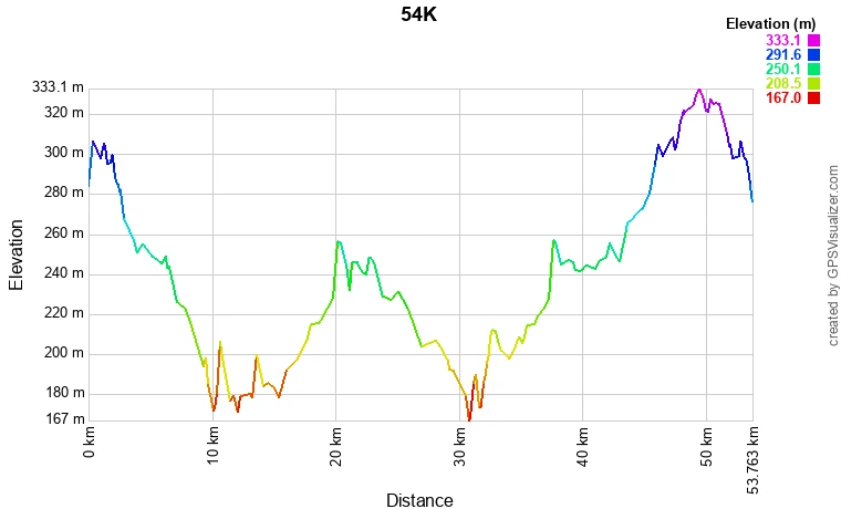
54K elevation profile
Over 53.76 km you climb +429 m and descend −436 m in total (elevation + / −: the higher, the tougher). Altitude ranges from 171 m to 332 m above sea level.
Official elevation profile (image)
54K map
36K · The Hare
Intermediate level“Quick and alert, it finds a way where there is none.”
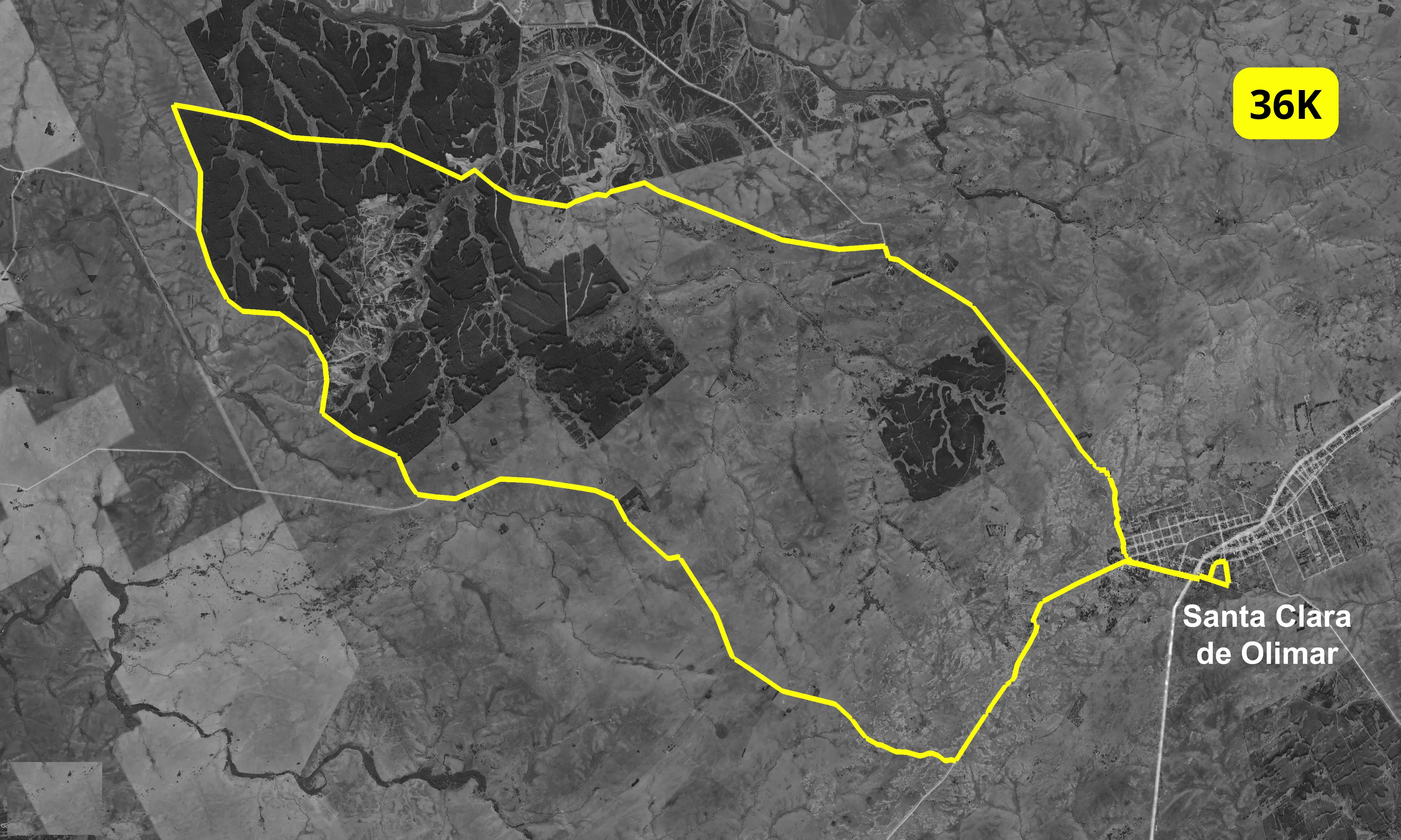
36 km you shouldn't underestimate.
You start at 5:00 AM from Santa Clara de Olimar, with the first section in the dark and sunrise during the race. The loop goes through town streets, countryside, streams and woodland, with changes of terrain that call for good preparation.
- Sun 28, 5:00 AMFirst section with a headlamp
- Accommodation includedYou sleep in Santa Clara on Saturday night
- +273 m elevation gainSpread over 36.34 km
- Varied terrainTown, countryside, streams and woodland
It's for you if…
- You've already run 21K or more and want to move from asphalt to the countryside.
- You train regularly and want a real challenge, short of an ultra.
- You want to experience the night start and the sunrise over the Cuchilla Grande.
36K elevation profile
Over 36.34 km you climb +273 m and descend −280 m in total (elevation + / −: the higher, the tougher). Altitude ranges from 172 m to 332 m above sea level.
Official elevation profile (image)

36K map
10K · The Armadillo
Beginner level“Step by step, the armadillo always gets there.”
This could be your first race.
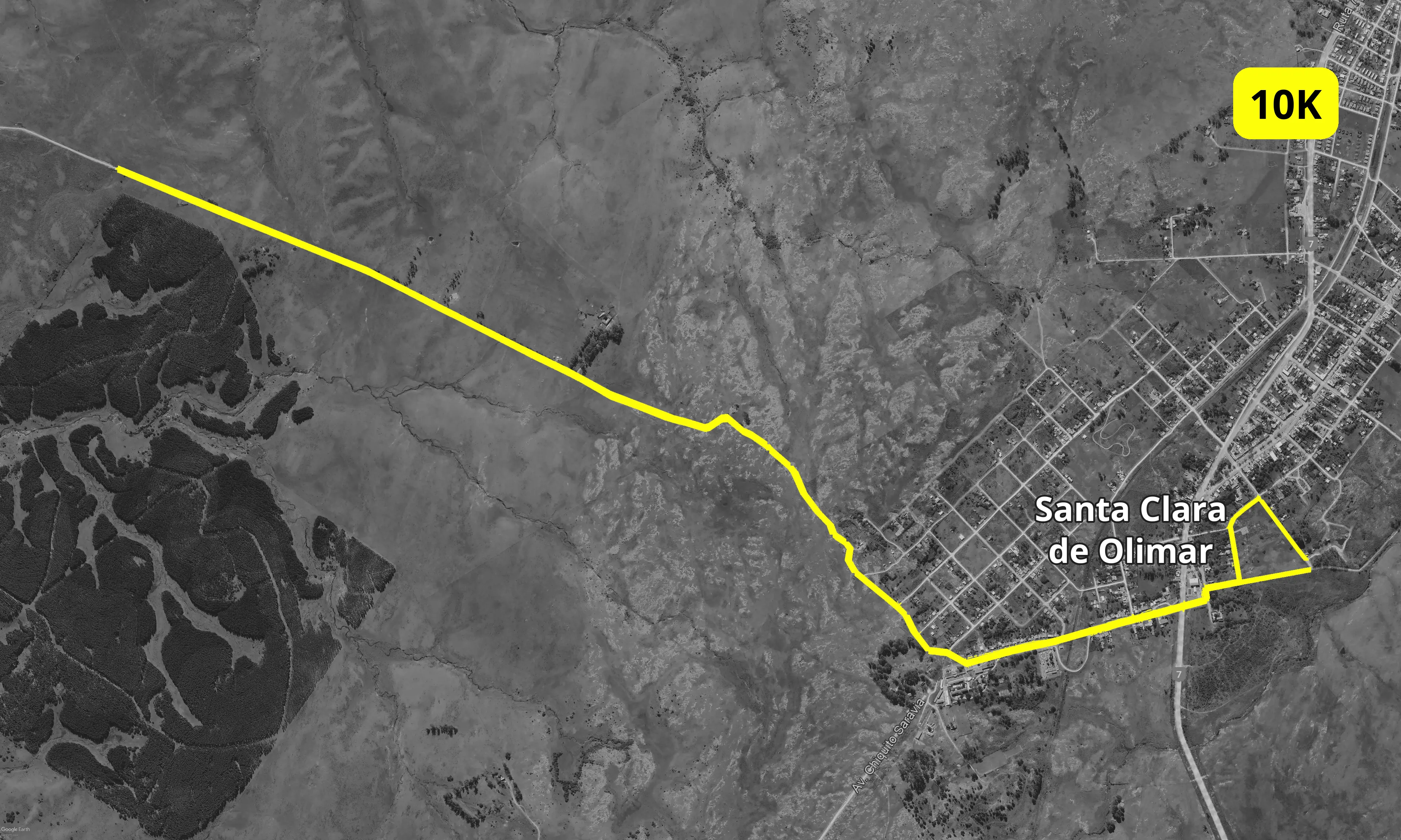
You start at 8:30 AM, in daylight, from Santa Clara de Olimar. It's a loop on paved streets and packed dirt roads, with no technical sections. You can run or walk it, and it's the only distance open to minors, with written permission from their parents.
- Sun 28, 8:30 AMIn daylight
- Asphalt and dirtFirm, accessible roads
- Running or walkingOpen to minors, with permission
- A medal for everyoneEveryone who finishes takes one home
It's for you if…
- You want to run your first race.
- You want to soak up the Ultra atmosphere without training for a long distance.
- You're coming along with someone running another distance and want to be part of it.
10K elevation profile
Over 10.14 km you climb +107 m and descend −114 m in total (elevation + / −: the higher, the tougher). Altitude ranges from 248 m to 307 m above sea level.
Official elevation profile (image)

10K map